
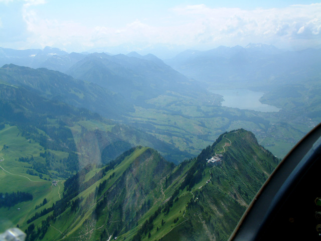
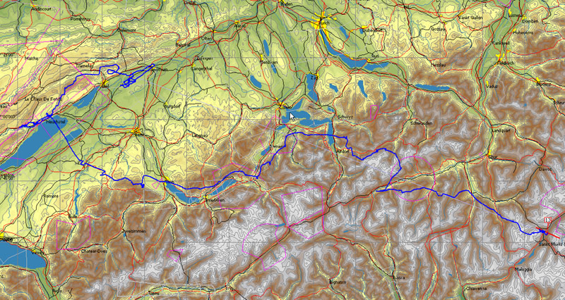
Arriving at Meiringen we have a choice of flying down the ridge on the northern side, past Interlaken, or going further south over Grindelwald. We choose the first route and have a good run for 30Km with fantastic views of the Interlaken (E) and the steep-sided, water-filled glacial valley in which it sits. We come off the end of the ridge near Thun and carry on westwards.
This time, we take a good look around the valley and decide that the western side seems much better, given the lack of a significant valley breeze and the appearance of a few shreds of cloud above the peaks. We pull a little bit harder and are rewarded with a 7,000' launch (1,400' QFE). We break right and head directly for the predetermined slope and are rewarded by a gentle 1-2Kt anabatic climb.
The Stanserhorn in the foreground throws us a lifeline with a weak climb. Whilst we make the most of this, the ridge ahead and to the left spawns cumulus and provides a route to Meiringen (D)
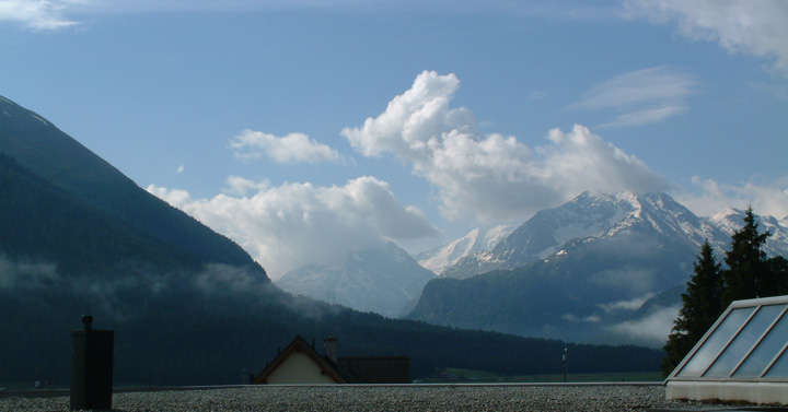
The view from room 13, early morning clouds and steaming trees
Looking at the weather forecast, today seems to be the last flying day of the expedition. (We have to be at Calais by tomorrow evening, too.) The day starts clear and dry but the chart has a weak front moving up from the SW, bringing cloud and stronger winds to Switzerland later on. We resolve to go as far as possible, then derig.
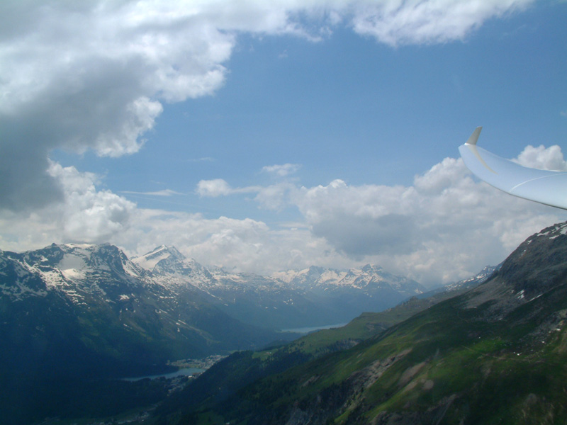
Drawing on our previous experiences at Samedan (and the advice of the locals), we take a winch launch on the SW run and immediately turn left and go round the corner onto the local ridge, the 'Muragl'. The 'Majola Wind' (supposed to blow directly onto the face of this mountain) is fitful today and, after a short struggle, we land back to try again.
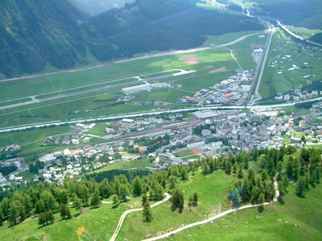
Just as we arrive on the ridge above Alpnach, small cumulus start to form along it. We throw a few turns over a spectacular mountain restaurant on the top of the Stanserhorn (C), then follow the clouds SW down towards Meiringen. The thermals are rather broken and unreliable but we manage to stay around 8,000'.
We arrive over the foothills of the Jura at about 1,500' AGL and then spend a frustrating hour grinding around in weak lift in a 25Kt wind, with one eye on the airfield at Neuchatel. Eventually we climb high enough and drift back along the slopes of the Chasseral, getting to 7,500'. Overhead, a spectacular cloud street persists at what looks like 10,000' plus. Finally we realise that this too is altocumulus, probably triggered off by the rise as the air flows over the Jura. But it is so convincing!
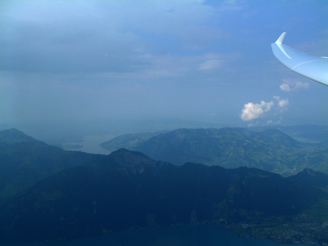
After half an hour of rock polishing we get to 11,500', say goodbye to the Engadine and set off to the NW. There are some reasonable climbs available but there is a large amount of medium cloud spreading in from the SW, cutting off most of the sun. We push west, past Thusis, in increasingly murky conditions, staying as close to cloudbase as we can. The base drops below 10,000' and the thermals become weaker. We look further west, towards the Oberalp Pass and Andermatt but there is no sun, so we make a U-turn then cross over to the northern side of the valley.
F
E
D
C
B
A
We sneak over into the Linthal and take a slow climb near the head of the Mollis Valley while we assess the situation. The High Alps are now completely covered with cloud but there are signs of sun breaking through about 50Km to the West. We tiptoe over the Klausen Pass (B) and top up with short, weak climbs under the increasing overcast. We set off towards Alpnach Airfield where we can see sunshine but no sign of convection. If it isn't soarable, we could land there or possibly Meiringen, 25Km further south.
Flat and lifeless to the North of the mountains, overcast over the high Alps
The way to Andermatt and the West is blocked, a stregic withdrawal is called for and we contemplate a more Northerly route (A)
A fantastic and unforgettable experience and a fitting end to a most successful trip.
The flight had been an utterly fascinating six-and-a-quarter hours. We had made many transitions between different airmasses and flew in everything from blue to 8/8. The scenery had been superb from alpine vistas to flatlands and lakes. We never knew quite where we were going to end up; indeed the flight could have come to a stop at several places en-route but we managed to soar away many times from apparently hopeless situations.
There is a thick, black layer of altocumulus and altostratus moving in overhead. We make a decision to come slightly south, towards the overcast, as we can see some suspicious 'fronds' forming about 10Km west of Thun Airfield. We work these up to 8,400' then head away from the mountains towards Fribourg, where we can see almost unbroken sunshine and what looks like a few shallow cu.
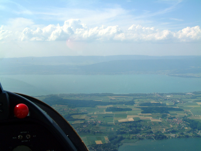
Once clear of the Alps, we notice the wind has picked up appreciably from the SW. The thermals are weak and blue and the 'cumulus' turn out to be thin bits of altocumulus. To the NW, over the Jura, there are some good looking cloudstreets so we set off on a glide towards Neuchatel, crossing the lake of that name.
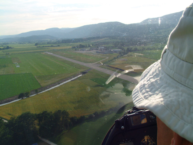
We could make the airfield at Delemont but we decide to land at Grenchen (F) as it is next to the motorway and hopefully has some reasonable facilities. We touch down at seven o'clock and park next to a short trailer rack. Our assessment proves correct and there is a restaurant and hotel on the airfield itself. Andy arrives shortly before dark with the trailer: we celebrate with beer and the 'last of the summer schnitzel'.
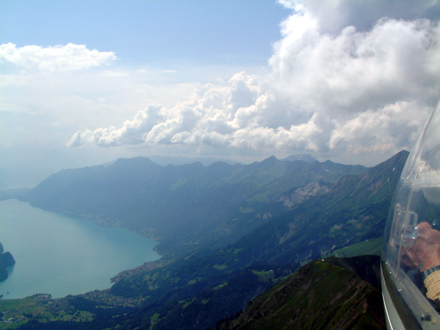


The spectacular ridge on the North side of Brienzer See and Interlaken situated between Brienzer See and Thuner See

Final landing of Euro 2004 at Grenschen in NE Switzerland